Applied Mathematics, Computational Modelling
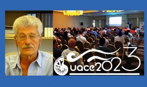
State-of-the-art Earth Observation Technologies for the Urban Environment
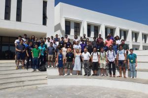
The Remote Sensing Lab (http://rslab.gr) of the Institute of Applied and Computational Mathematics of FORTH, organized the International Conference "Joint Urban and Remote Sensing Event - JURSE2023" (http://jurse2023.org), from 17 to 19 May 2023.
Summer Graduate School on Geometric Flows
The Institute of Applied and Computational Mathematics of the Foundation for Research and Technology Hellas (IACM-FORTH), in collaboration with the Mathematical Sciences Research Institute (MSRI) and with the support of the Stavros Niarchos Foundation (SNF) organized a Summer Graduate School on Geometric Flows.
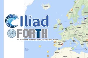
EU Awards €17 million to ILIAD Project to Launch an Innovative Digital Twin of The Ocean
The ILIAD consortium, which includes 56 international partners, will develop virtual representations of the sea that will integrate and extend existing EU earth observing, modelling digital infrastructures and computing facilities to provide highly accurate predictions of future developments.
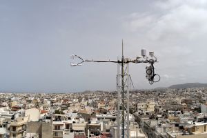
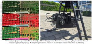
Flux Towers for the direct measurement of heat and carbon dioxide (CO2) emissions installed in Heraklion by FORTH, towards making the city a reference point for the future CO2 emission monitoring system of the European Commission.
The research is carried out by the Remote Sensing Laboratory of FORTH operating the Flux Towers and processing the valuable data extracted.
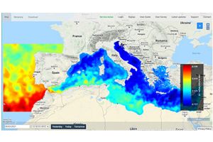
Monitoring of the recent tidal phenomenon in the Mediterranean basin by FORTH - The MARINOMICA oceanographic monitoring platform of the H2020 ODYSSEA project
A recent tide observed at the beaches of Crete has reasonably aroused public interest or concern, for upcoming consequences. But was it just a local phenomenon? Which areas were most affected? How does it evolve over time?
Mapping of the flooded areas by the Coastal and Marine Research Laboratory of FORTH
The Coastal and Marine Research Laboratory of FORTH, carried out field surveys at the coastal zone of the Municipality of Chersonissos on Friday 11 December 2020, to have an overview of the situation of the areas that were affected by the recent storm, in the framework of its collaboration with the Directorate for Environment and Hydro-economy of the Region of Crete.
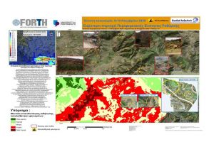
FORTH at the service of the Local Authorities. The valuable contribution of Geoinformatics in the prevention and treatment of landslides
The unprecedented rainfall of high amount and intensity that hit the island of Crete during the 9-10th of November, 2020 had as a result the occurrence of extensive floods and landslides in residential and rural areas of the island. Among the severely affected areas was the Regional Unit of Rethymno, with the effects of severe weather on both infrastructures (damages to constructions and road network) and in its primary sector (destruction of crops) being characterized as incalculable.